
 Here is information about Sheet 226 & 227:
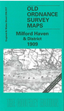
This Inch to the Mile map covers the SW area of Pembrokeshire around St Bride's Bay. Sheet 226, which includes Grassholme Island and The Smalls, is shown as an inset on the main map, 227. This covers an area stretching from Skomer Island eastward to Milford Haven, and from Roch southward to Angle. On the reverse is an extract from Pembrokeshire Sheet 26.16, showing Little Haven and Broad Haven (part of Walton West parish) in detail; a directory for Walton West is also included.
It is not possible to list the many hamlets, farmsteads and other topographical features shown on these maps. However, you may find it useful if we list the towns and principal villages or church parishes that are included on this map:
Index maps are available showing the areas covered by the Inch to the Mile maps. Go to This page
You can order maps direct from our On-line Mapshop. For a full list of Inch to the Mile maps go to the Inch to the Mile page, where you will also find details of prices. For information on the rest of the series, go to The Index Page.