
 Here is information about Sheet 182:
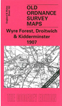
This One Inch to the Mile map covers a large area of west Worcestershire, with tiny fragments of Shropshire and Herefordshire also included. Coverage stretches from Hanley William and Cleobury Mortimer eastward to the outskirts of Bromsgrove; and from Kidderminster southward to Grimley and Martley. The River Severn runs through the map and transport interests include the Droitwich Canal, Tenbury & Bewdley Branch railway, and Cleobury Mortimer & Ditton Priors Light Railway. On the reverse we include an extract from Shropshire Sheet 80.02, covering the centre of the samall town of Cleobury Mortimer, complete with diurectory
It is not possible to list the many hamlets, farmsteads and other topographical features shown on these maps. However, you may find it useful if we list the towns and principal villages or church parishes that are included on this map. Links are given for those for which detailed large-scale maps are also available.
Index maps are available showing the areas covered by the Inch to the Mile maps. Go to This page
You can order maps direct from our On-line Mapshop. For a full list of Inch to the Mile maps go to the Inch to the Mile page, where you will also find details of prices. For information on the rest of the series, go to The Index Page.