
 Here is information about Sheet 180:
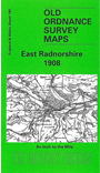
This Inch to the Mile map covers much of east Radnorshire, with fragments of Shropshire and Herefordshire to the east. Coverage stretches from Llanddewi-Ystradenni eastward to Bucknell and Kinsham, and from Hopton Castle southward to New Radnor. Radnorshire's little capital, Presteigne is on the map, complete with its branch railway, and the lovely Central Wales line winds through the map. Radnor Forest is near the foot of the map. On the back we include a detailed map of New Radnor, a former capital of the county, together with a directory; this still describes it as a "market town and ancient borough", despite a population of just 405.
It is not possible to list the many hamlets, farmsteads and other topographical features shown on these maps. However, you may find it useful if we list the towns and principal villages or church parishes that are included on this map. Links are given for those for which detailed large-scale maps are also available.
Index maps are available showing the areas covered by the Inch to the Mile maps. Go to This page
You can order maps direct from our On-line Mapshop. For a full list of Inch to the Mile maps go to the Inch to the Mile page, where you will also find details of prices. For information on the rest of the series, go to The Index Page.