
 Here is information about Sheet 178:
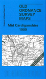
This Inch to the Mile map covers an entirely rural area, from immediately south of Aberystywyth southward to just north of Tregaron. The 'Manchester & Milford Section' railway runs through the map, and part of the Devil's Bridge narrow gauge line is also shown. Other features include the Strata Florida abbey, and various lead mines (though that industry was in decline). On the reverse we include an extract from Cardiganshire Sheet 14.11 showing Llanrhystyd in detail in 1904, complete with directory.
It is not possible to list the many hamlets, farmsteads and other topographical features shown on these maps. However, you may find it useful if we list the towns and principal villages or church parishes that are included on this map. Links are given for those for which detailed large-scale maps are also available.
Index maps are available showing the areas covered by the Inch to the Mile maps. Go to This page
You can order maps direct from our On-line Mapshop. For a full list of Inch to the Mile maps go to the Inch to the Mile page, where you will also find details of prices. For information on the rest of the series, go to The Index Page.