
 Here is information about Sheet 157:
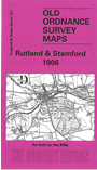
This One Inch to the Mile map covers much of the tiny county of Rutland, but smaller areas of other counties also intrude: a fragment of Leicestershire in the SW corner; Lincolnshire, including the historic town of Stamford, in the NE; Northamptonshire to the south and east, and a small area of Huntingdonshire in the SE corner. In fact, a sixth county might be said to be here, for part of Northamptonshire is in the Soke of Peterborough, shown by the OS here as a county in its own right. Features include several great estates: Exton Park, Normanton Park, Burghley Park, as well as some long lost railways: the Stamford & Essendine Branch; Rugby & Stamford Branch; and the LNWR Rugby-Peterborough line. On the back we include an extract from Rutland Sheet 10.15, showing the village of Ketton in detail, complete with directory.
It is not possible to list the many hamlets, farmsteads and other topographical features shown on these maps. However, you might find it useful if we here list the majority of the principal villages and church parishes that are included on this map. Links are given for those for which detailed large-scale maps are also available.
Index maps are available showing the areas covered by the Inch to the Mile maps. Go to This page
You can order maps direct from our On-line Mapshop. For a full list of Inch to the Mile maps go to the Inch to the Mile page, where you will also find details of prices. For information on the rest of the series, go to The Index Page.