
 Here is information about Sheet 121:
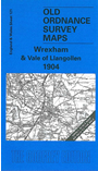
This Inch to the Mile map covers Wrexham and the area to the west, through the Llangollen Valley and across Ruabon Mountain, Eglwyseg Mountain, Llantysilio Mountain and Cyrn-y-Brain. Coverage stretches from Carrog and Llanelidan eastward to Overton, and from Brymbo southward to Chirk, and the map is an ideal accompaniment to the group of larger scale maps we have published for the Wrexham area. Though most of the map is Denbighshire, there are also smaller areas of Merioneth (around Carrog) and Shropshire, and two detached parts of Flintshire. Close examination will find a network of railways, collieries and iron works in the area west of Wrexham, and a good stretch of the Llangollen & Corwen railway is also included. On the reverse we include an extract from Denbighshire Sheet 40.10, showing Chirk in detail in 1909.
It is not possible to list the many hamlets, farmsteads and other topographical features shown on these maps. However, you may find it useful if we list the towns and principal villages or church parishes that are included on this map. Links are given for those for which detailed large-scale maps are also available.
Index maps are available showing the areas covered by the Inch to the Mile maps. Go to This page
You can order maps direct from our On-line Mapshop. For a full list of Inch to the Mile maps go to the Inch to the Mile page, where you will also find details of prices. For information on the rest of the series, go to The Index Page.