
 Here is information about Sheet 107:
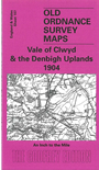
This One Inch to the Mile map covers much of north Denbighshire, including Denbigh itself, with a small section of Flintshire in the NE corner. Coverage stretches from the hills of Moel Gyffylog, Mwdwl Eithin, Moel Seisiog and Cefn Rhydd eastward to Bodfari, and from St Asaph southward to Gyffylliog and Moel Llyn. Much of the south and west of the map is of the Denbigh Uplands, with the more populated area north and east, including the two towns on the map, Denbigh and St Asaph. On the reverse we include an extract from Denbighshire Sheet 7.11, showing Llanfair Talhaiarn in 1910 in some detail.
It is not possible to list the many hamlets, farmsteads and other topographical features shown on these maps. However, you may find it useful if we list the towns and principal villages or church parishes that are included on this map. Links are given for those for which detailed large-scale maps are also available.
Index maps are available showing the areas covered by the Inch to the Mile maps. Go to This page
You can order maps direct from our On-line Mapshop. For a full list of Inch to the Mile maps go to the Inch to the Mile page, where you will also find details of prices. For information on the rest of the series, go to The Index Page.