
 Here is information about Sheets 81 & 82:
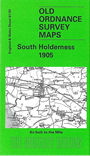
This One Inch to the Mile map covers the southern end of Holderness, described by Philip Larkin as "lonelier and lonelier, and after that the birds and lights of Spurn Head, and after that the sea". The map does not quite capture the tip of Spurn Head but the atmosphere of Holderness is here. The map captures the area from Marfleet eastward to the coast, and southward to Habrough on the Lincolnshire side of the Humber. On the reverse we include a detailed map of the small but ancient town of Hedon, complete with directory.
It is not possible to list the many hamlets, farmsteads and other topographical features shown on these maps. However, you may find it useful if we list the towns and principal villages or church parishes that are included on this map. Links are given for those for which detailed large-scale maps are also available.
Index maps are available showing the areas covered by the Inch to the Mile maps. Go to This page
You can order maps direct from our On-line Mapshop. For a full list of Inch to the Mile maps go to the Inch to the Mile page, where you will also find details of prices. For information on the rest of the series, go to The Index Page.