
Old Ordnance Survey Inch to the Mile Maps
These maps normally cover an area of about 18 miles by 12 miles and are especially good at showing railways, roads and canals, and at giving
a broad view of a wider area. Each includes an introduction and a more detailed map of a small town or village.
They are available through our On-line Mapshop
 Here is information about Sheet 14:
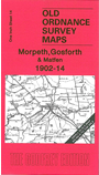
One Inch Sheet 14 Morpeth, Gosforth & Matfen 1902-14 - published 2004; intro by John Griffiths. ISBN.978-1-84151-727-8
This One Inch Ordnance Survey map covers the area of Northumberland from Kirkwhelpington eastward to Bedlington, southward to Gosforth and Killingworth station. Much of the map is rural but to the
south and east we find the Northumberland coalfield with several collieries and their mineral lines. Other railways include the Darras Hall branch and the NBR line westward from Morpeth. On the
reverse is a detailed map of the village of Matfen, including Matfen Hall.
It is not possible to list the many hamlets, farmsteads and other topographical features shown on these maps. However, you may find it useful if we list the towns and
principal villages or church parishes that are included on this map. Links are given for those for which detailed large-scale maps are also available.
Northumberland: Bedlington, Belsay, Berwick Hill, Black Callerton, Black Heddon, Bolam, Bradford, Brenkley, Burradon, Camperdown, Capheaton, Clarewood, Coxlodge,
Cramlington, Dalton, Darras Hall, Dinnington, Eachwick, East Brunton, East Shaftoe, Edington, Fenwick, Gallowhill, Great Whittington, Halton, Harlow Hill, Harnham,
Hartburn, Hawkwell, Hepscott, Heugh, High Angerton, High Callerton, Higham Dykes, Ingoe, Kearsley, Kenton, Kirkharle, Kirkheaton, Kirkwhelpington, Little Whittington, Longbenton, Low Angerton, Matfen,
Meldon, Milbourne, Mitford, Molesden, Morpeth, Newton Underwood, Ogle, Ouston, Ponteland, Prestwick,
Ryal, South Gosforth, Spital Hill, Stannington, Throphill, Tranwell, Twizell, Welton, Whalton, Whitchester, Wide Open.
Index maps are available showing the areas covered by the Inch to the Mile maps. Go to This page
You can order maps direct from our On-line Mapshop. For a full list of Inch to the Mile maps go to the Inch to the Mile page,
where you will also find details of prices. For information on the rest of the series, go to The Index Page.
Alan Godfrey Maps, Prospect Business Park, Leadgate, Consett, Co Durham, DH8 7PW / sales@alangodfreymaps.co.uk / 16 April 2011