 Here are details of our map for south Newport:
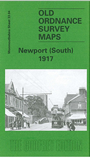
This detailed map covers the southern part of the city of Newport, with coverage stretching from Emlyn Street southward to the Transporter Bridge, and from the Old Dock westward to Upton Road. The many features include St Woollos church (now cathedral), Workhouse, Bellevue Park, Commercial Road area, Pillgwenlly, Stow Park, tramways, Caerau Park area, railways with many junctions, Maes-glas Junction, stretches of Alexandra (Newport & S Wales) Railway with Mendalgyf Sidings, GWR Newport Neutral Mile, stretch of Monmouthshire Eastern Valleys line with lines to docks, Tredegar Dry Dock, Uskside Iron Works, west end of Transporter Bridge, Isca Foundry, GWR loco yard, Salutation Junction, Pillbank Junction, Old Dock, Royal Gwent Hospital, St Stephen's church, Holy Trinity church, Mary Dry Dock, Edith Dry Dock, Alice Dry Dock, St Paul's church etc. On the reverse we include extracts from a street directory, incl Commercial Road, Dock Street, Mill Parade, Stow Hill, York Place.
The map links up with Monmouthshire Sheet 28.16 Newport North to the north.