 Here are details of our map for north Newport:
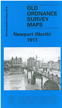
This detailed map covers the northern part of the city of Newport, with coverage stretching from Charles Street northward to Stafford Road, and from Bishton Street westward to Fields Park Avenue. Features include railway with Newport station; Maindee West, East and North Junctions; Maindee Branch Junction, Monmouthshire Eastern Valleys Line, tramways, Monmouthshire & Brecon Canals, Llanarth Street Junction, River Usk with many wharves, East Usk Oil Works, tramway depot, Dos Nail Works, Newport Athletic Club Grounds, gas works, Baneswell area, Clytha Park area, Isolation Hospital, Barracks, Market, Council Offices, Bridge Street area, Newport Bridge etc. We include a selection of street directory entries on the reverse, incl Bridge Street, Clytha Park Road, Commercial Street, Fields Road, High Street, Malpas Road.
The map links up with Monmouthshire Sheet 33.04 Newport South to the south.