Old OS Town Plans of Liverpool


  • For a few areas of Liverpool and Manchester we have also reprinted some of the very early Five-foot plans. Originally published at a scale of 1:1056 or 5 feet to the mile, we have reduced them in scale to 1:1760 or a Yard to the Mile. The maps, though covering quite a small area, are quite wonderfully detailed, showing such features as capstans and mooring posts, lamp-posts, the layouts of back yards, and even the interior of certain buildings such as churches. For the urban historian they are perhaps the most fascinating maps ever published by the Ordnance Survey.
  • Maps can be purchased on our On-line Mapshop.

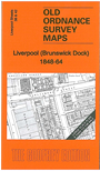
  • Here are the details of maps for Brunswick Docks:

  • Liverpool Sheet 38/42 Liverpoool (Brunswick Dock) 1848-64 - published 2012; intro by Kay Parrott. ISBN.978-1-84784-586-3.

    This very detailed map includes sheet 38 and the busy area of sheet 42 to the south, giving very good coverage of Liverpool's southern docks.

    Features include Southern & Toxteth Hospital, Queen's Dock, graving docks, Union Dock, Coburg Dock, Brunswick Dock, part of Toxteth Dock, South Dock Yard, Line of Docks Railway, Brunswick Dock Police Station, shipwrights yards, Trafalgar Dock etc. The docks are shown with remarkable detail, even including minutiae such as cranes, tar boilers, lamp posts.

    The map links up with Liverpool Sheet 34 Wapping to the north and 39 Toxteth Mill St to the east.


  • Follow this link for a complete list of our Liverpool maps.
  • You can order maps direct from our On-line Mapshop. For other information and prices, and other areas, go to The Index Page.
  • This map is taken from the five foot map and reduced to a scale of a yard to the mile. For a full list of maps for the North West, return to the North West page.
    The Godfrey Edition / sales@alangodfreymaps.co.uk / 18 January 2018