 Here are the details of maps for West Derby:

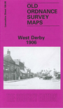
This detailed map covers the West Derby area, NE of Liverpool. Coverage stretches from Lark Hill Lane eastward to Deysbrook Lane; and from Sandfield Park northward to Almond Green. Features include St Mary's church, West Derby Orphanage, Cheshire Lines Railway with West Derby station, St James church, tramway, Lark Hill, numerous villas (several of them named), Broughton Terrace, Croxteth View, Leyfield Farm, Crown Brewery etc. On the reverse we include a selection of street directory entries, incl Almonds Green, Crosby Green, Hartington Road, Town Row, West Derby Village.
This map links up with sheet 106.04 Croxteth Hall to the north, 106.07 Anfield to the west, 106.12 Knotty Ash to the south.