 Here are the details of maps for Ashton-under-Lyne & Stalybridge:


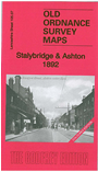
We have published two versions of this map, showing how the area changed across the years. It covers the eastern part of Ashton and central Stalybridge. Smaller parts of Hurst UDC and Dukinfield are also included. Coverage stretches from St Michael's church in Ashton eastward to Holy Trinity church Stalybridge, and from Russell Street southward to Cross Leech Street. The whole area is today part of Tameside. Features include Ashton under Lyne Workhouse, infirmary, Albion Church, Hurst Brook, Botany, tram depot, Lees Square, Stamford Square, Stamford Park, Dukinfield Bridge, Dukinfield Lodge, Tame Valley, Highfield House, Stalybridge station, Swanwick Clough, Cocker Hill, Ridge Hill, Globe Iron Works. Several railways (including Stalybridge Junction Line) run through the map; also the Huddersfield Canal with Ashton Old Wharf. The many mills include Wellington Mills, Whitelands Twist Mill, Tameside Mills, Crescent Mills, Clarence Mill, Grosvenor Street Mills and many more. Several tramways are also shown. The 1892 version is in colour.
The map links up with Lancashire Sheets 105.03 Hurst to the north, 105.06 Ashton under Lyne to the west; also with Cheshire Sheet 3.09 Ashton & Dukinfield and 3.10 Stalybridge.