Old Ordnance Survey Maps of Wigan MBC

  • These detailed maps normally cover an area of about one and a half miles by one mile. Each map includes an introduction.
  • They are available through our On-line Mapshop

  • Here are the details of maps for Lowton:

  • Lancashire 102.10 Lowton St Mary's 1925 - published 2021; intro by Alan Godfrey. ISBN.978-1-78721-475-0

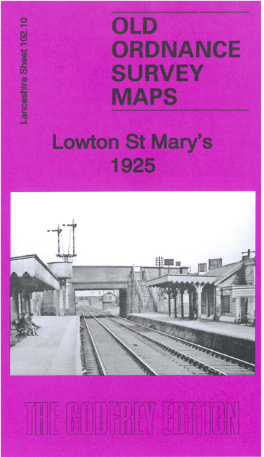
    This detailed map covers Lowton Common and Lowton St Mary's.

    Features include LNER railways with Lowton St Mary's station, Lowton Sidings, LMSR railway with southern tip of Pennington station, tramways, Pocket Nook House, Soap & Glue Works, Oaklands, Jolly Carter Inn, St Mary's church, Dale Hall, Wash End, Liptrot Farm, Green's House Farm, Knott's Houses, cotton mill, Verandah House, Robin Hood Farm etc. On the reverse we include a good section of the six-inch map for the area in 1944, showing some of the buildings that became HMS Cabbala.

    The map links up with sheets 102.06 Pennington Flash to the north, 102.09 Golborne to the west.


  • Follow this link for a complete list of our Wigan or Bolton maps.
  • You can order maps direct from our On-line Mapshop. For other information and prices, and other areas, go to The Index Page.
  • Maps in the Godfrey Edition are taken from the 25 inch to the mile map and reduced to about 15 inches to the mile. For a full list of maps for the North West, return to the North West page.
    The Godfrey Edition / sales@alangodfreymaps.co.uk / 22 September 2021