
 Here are the details of maps for Bradley Fold:

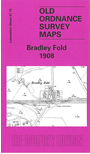
This detailed map covers the hamlet of Bradley Fold, midway between Bolton and Bury. This was a semi rural area and features include Bradley Fold with station, Bradley Fold Works, Bradley Fold Pottery, Bradley Fold Print Works, Ainsworth Mills, Ainsworth Vale Dye Works, Ainsworth Mercerising Works, Coggra Fold. Bradley Fold Junction is near the eastern margin. On the reverse we include a large section of the 1927 revision of the map, showing much more industrial development, now including Fold Mill, Starmount Print Works, Lomax Bank Paper Mill, a much larger Bradley Fold Works, St Oswald's Mission church and other development along Bury New Road.
The map links up with Lancashire Sheets 87.11 Ainsworth to the north, 87.14 Bolton East to the west, 87.16 Radcliffe North to the east and 95.03 Little Lever to the south.