
 Here are the details of maps for Bury (West):

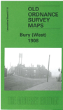
This detailed map covers the western part of Bury, including Eelton and Elton Fold. Coverage extends westward to Starling, Starling Road and Lower Croft Mill. Features include Seddon's Farm, Wellington Barracks, a stretch of the Bolton-Bury railway line with Bury Corp.Gas Siding, Whitehead Recreation Ground, Lower Hinds, Manchester Bolton & Bury Canal, River Irwell, tramways, Florence Nightingale Hospital, Wellington Mills, New Victoria Mills, Daisyfield Mills, Albion Mills, Waterside Mill, Egyptian Mills, Elton Paper Mills Atlas Iron Works, Gas Works.On the reverse we include extracts from a contemporary trade directory, incl lists of Clergy, plus street directory entries for Belbeck Street, Bolton Road, Charles Street, Wood Street.
The map links up with Lancashire Sheets 87.08 Bury NW to the north, 87.11 Ainsworth to the west, 88.09 Bury to the east and 87.16 Radcliffe North to the south.