Old Ordnance Survey Maps of Edinburgh

  • These detailed maps normally cover an area of about one and a half miles by one mile. Each map includes an introduction.
  • They are available through our On-line Mapshop

  • Here are the details of maps for Liberton:

  • Edinburghshire Sheet 3.16 Liberton Dams 1896 - published 1984; intro by Barbara & R.J.Morris. ISBN.978-0-90755-464-6

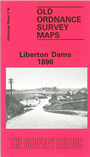
    This detailed map covers an area of south Edinburgh that includes Liberton Dams, Craigmillar and part of Blackford. Coverage stretches from West Savile Road southward to Liberton Tower Mains, and from the Royal Observatory eastward to Northfield.

    Features on the map include Brae Side Cottages, Blackford Quarries, Inch, Bridge End, Liberton East Mains, Blackfordhill station. On the reverse we include a section of the 1908 edition of the map, showing how the area around Craigmillar changed.

    The map links up with Edinburgh Sheets 3.12 Newington to the north, 3.15Morningside to the west.


  • Follow this link for a complete list of our Edinburgh maps.
  • You can order maps direct from our On-line Mapshop. For other information and prices, and other areas, go to The Index Page.
  • Maps in the Godfrey Edition are taken from the 25 inch to the mile map and reduced to about 15 inches to the mile. For a full list of maps for Scotland, return to the Scotland page.
    The Godfrey Edition / sales@alangodfreymaps.co.uk / 29 October 2016