Old Ordnance Survey Maps of County Durham

  • These detailed maps normally cover an area of about one and a half miles by one mile. Each map includes an introduction.
  • They are available through our On-line Mapshop

  • Here are the details of maps for South Moor:

  • Co Durham Sheet 12.10 South Moor & West Stanley 1915 - published 2016; intro by Alan Godfrey. ISBN.978-1-78721-006-6

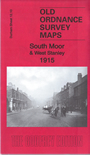
    This very detailed map covers South Moor and part of Stanley and the Middles.

    Features include West Stanley pit, Louisa pit, NER railway, wagonways and tramways, Bloemfontein terrace, Miners Rescue station, two picture theatres, St George's church, South Moor, Stanley's Front Street, etc. This map shows the area just sic years after the dreadful West Stanley pit disaster, the worst mining accident in Durham's history. Directory extracts for Craghead and South Moor are included on the reverse.

    The map links up with Sheet 12.06 Stanley to the north, 12.09 Annfield Plain to the west, 19.02 Burnhope to the south,


  • Follow this link for a complete list of our Durham maps.
  • You can order maps direct from our On-line Mapshop. For other information and prices, and other areas, go to The Index Page.
  • Maps in the Godfrey Edition are taken from the 25 inch to the mile map and reduced to about 15 inches to the mile. For a full list of maps for England, return to the England page.
    Alan Godfrey Maps, Prospect Business Park, Leadgate, Consett, Co Durham, DH8 7PW / sales@alangodfreymaps.co.uk / 14 January 2018