Old Ordnance Survey Maps of Cheshire


  • These detailed maps normally cover an area of about one and a half miles by one mile. Each map includes an introduction.
  • They are available through our On-line Mapshop

  • Here are the details of maps for Winsford & Over:

  • Cheshire Sheet 41.09 Winsford 1908 - published 2007; intro by Derrick Pratt. ISBN.978-1-84784-005-9

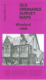
    This detailed map covers the Cheshire town of Winsford, with coverage also including Over and part of Wharton. Coverage stretches from Sandhole and Delamere Street eastward to Ledward Street at Wharton. Features include the railway termini of both CLC and LNWR, several salt works, Wharton Hall, Knight's Grange, Gravel Hill, High Street, Town Hall, Over Mills. We include directories of private residents for Over and Winsford on the reverse.


  • Follow this link for a complete list of our Cheshire maps.
  • You can order maps direct from our On-line Mapshop. For other information and prices, and other areas, go to The Index Page.
  • Maps in the Godfrey Edition are taken from the 25 inch to the mile map and reduced to about 15 inches to the mile. For a full list of maps for the North West, return to the North West page.
    The Godfrey Edition / sales@alangodfreymaps.co.uk / 27 January 2018