Old Ordnance Survey Maps of Cheshire


  • These detailed maps normally cover an area of about one and a half miles by one mile. Each map includes an introduction.
  • They are available through our On-line Mapshop

  • Here are the details of maps for Knutsford (S):

  • Cheshire Sheet 27.13 Knutsford (South) 1908 - published 2004; intro by Derrick Pratt. ISBN.978-1-84151-709-4

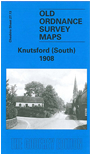
    This detailed map covers the the southern part of Knutsford, with coverage stretching from St John's church (at margin of map) southward to Bexton Hall and Sandfield Wood. Features include railway station, Bexton Saw Mills, Sudlow Farm, Yewtree Farm, Legh Road with villas, Court House, Bucklow Union Workhouse, Sanctuary Moor etc. On the reverse we include a list of private residents from a 1896 directory.

    The map links up with Cheshire sheet 27.09 Knutsford North to the north.


  • Follow this link for a complete list of our Cheshire maps.
  • You can order maps direct from our On-line Mapshop. For other information and prices, and other areas, go to The Index Page.
  • Maps in the Godfrey Edition are taken from the 25 inch to the mile map and reduced to about 15 inches to the mile. For a full list of maps for the North West, return to the North West page.
    The Godfrey Edition / sales@alangodfreymaps.co.uk / 27 January 2018