Old Ordnance Survey Maps of Cheshire


  • These detailed maps normally cover an area of about one and a half miles by one mile. Each map includes an introduction.
  • They are available through our On-line Mapshop

  • Here are the details of maps for Thelwall:

  • Cheshire Sheet 17.05 Thelwall 1908 - published 2003; intro by Chris Makepeace. ISBN.978-1-84151-521-2

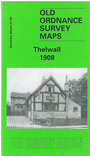
    Note that due to an error this map bears the sheet number '27.05'.


    This detailed map covers the village of Thelwall, on the south side of the Mersey, just east of Warrington. Coverage stretches from Morrisbrook Farm eastward to Thelwall Bridge, and from the Mersey southward to Massey Hall. Features include Thelwall station on the LNWR, Thelwall Hall, a stretch of the Manchester Ship Canal, Mostyn Tube Works, All Saints church, Greenfield House, Old Hall Farm, Massey Hall, Dog & Dart Inn, Thelwall Ferry etc. On the reverse we include a directory of Thelwall plus a railway timetable for the Manchester-Arpley-Liverpool line in 1929.


  • Follow this link for a list of our Warrington area maps.
  • You can order maps direct from our On-line Mapshop. For other information and prices, and other areas, go to The Index Page.
  • Maps in the Godfrey Edition are taken from the 25 inch to the mile map and reduced to about 15 inches to the mile. For a full list of maps for the North West, return to the North West page.
    The Godfrey Edition / sales@alangodfreymaps.co.uk / 27 January 2018