
 Here are the details of maps for Birkenhead (West):

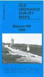
This detailed map covers the western part of Birkenhead, with coverage extending from Forest Road westward to Bidston Hill and Eleanor Road. Features include St Aidan's College, Lingdale House, St Bede's church, Bidston Lodge, Albert Memorial Industrial Schools, western end of Birkenhead Park, cemetery, infectious diseases hospital, Taylor's Wood, Park Wood, Bidston Lighthouse, Bidston Observatory etc. We include a selection of street directory entries on the reverse, incl Ashburton Road, Corporation Road, Eleanor Road, Lingdale Road, Tollemache Road, Upton Road.
The map links up with Cheshire sheet 7.14 Bidston to the north, 13.03 Birkenhead to the east.