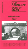
 Here are the details of maps for Whitehaven (North):

This detailed map covers the centre of Whitehaven, with coverage extending from Whitehaven Castle northward to Beatty Road and South View Road; and eastward to Low Harras.
Features include town centre with individual buildings neatly delineated; railway with Bransty station, William Pit with railway sidings, Wellington Pit with mineral branch, Howgill Incline, Outer Harbour, Inner Harbour, South and North Harbours, Queen's Dock, North Shore Works, St Nicholas church, tanneries, Castle Park, Crowpark Wood, Harras Park, St James church, Old Mill carpet factory, Market Hall, Harbour Commissioner's Railway incl line through Market Place, etc. On the reverse we include extracts from a 1921 directory.
The map links up with Cumberland sheet 67.06 Whitehaven South to the south.