Old Ordnance Survey Maps of Bedfordshire

  • These detailed maps normally cover an area of about one and a half miles by one mile. Each map includes an introduction.
  • They are available through our On-line Mapshop

  • Here are the details of maps for Kempston:

  • Bedfordshire Sheet 16.03 Kempston 1924 - published 1993, intro by Barry Stephenson. ISBN.978-0-85054-609-5

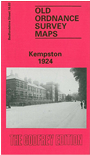
    This detailed map of Kempston includes an extract from sheet 16.07 for maximum coverage of the town. Features on this map include Springfield House, St Stephens Church, St Johns Church, Cauldwell House, Saxon Burial Ground (site of), Kempston Grange and The Leather Works. Main streets on the map are Bedford Road, High Street, Elstow Road and Spring Road. On the reverse of the map includes the area south of the main map to include Kempston Works, The School and Postley Farm.


  • Follow this link for a complete list of our Bedfordshire maps.
  • You can order maps direct from our On-line Mapshop. For other information and prices, and other areas, go to The Index Page.
  • Most maps in the Godfrey Edition are taken from the 25 inch to the mile map and reduced to about 15 inches to the mile. For a full list of maps for England, return to the England page.
    The Godfrey Edition / sales@alangodfreymaps.co.uk / 22 January 2018