Old Ordnance Survey Maps of Bedfordshire

  • These detailed maps normally cover an area of about one and a half miles by one mile. Each map includes an introduction.
  • They are available through our On-line Mapshop

  • Here are the details of maps for West Bedford:

  • Bedfordshire Sheet 11.15 West Bedford & Biddenham 1924 - published 1991, intro by Barry Stephenson. ISBN.978-0-85054-451-0

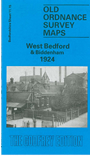
    This map of West Bedford shows Queens Park and St Pauls West Ward. The London, Midland & Scottish railway runs diagonally through the right hand corner of the map. Features include Pyghtle Works, Biddenham Works and Queens Works, with main streets such as Ford End Road, Hurst Grove South and Chaucer Road. To the left of the map includes Biddenham, which features the Vicarage, Biddenham House and Manor Farm. On the reverse of the map we include a street directory for the area.


  • Follow this link for a complete list of our Bedfordshire maps.
  • You can order maps direct from our On-line Mapshop. For other information and prices, and other areas, go to The Index Page.
  • Most maps in the Godfrey Edition are taken from the 25 inch to the mile map and reduced to about 15 inches to the mile. For a full list of maps for England, return to the England page.
    The Godfrey Edition / sales@alangodfreymaps.co.uk / 22 January 2018