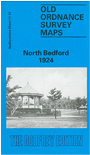
Bedfordshire Sheet 11.12 North Bedford 1924 - published 1992, intro by Barry Stephenson. ISBN.978-0-85054-493-0 
This detailed map of North Bedford covers the St Peters Ward and North Ward area. Features include St Andrews Church, The Park, Mortuary Chapels and Cemetery, Water Works, Cricket Ground, Brickhill House and Farm and Park Hotel.
Main streets on the map are Stanley Street, Park Avenue, Kimbolton Road and Foster Hill Road. On the reverse of the map we include an extract from the Inch to the Mile sheet 203 - Bedford & District.
Follow this link for a complete list of our Bedfordshire maps.
You can order maps direct from our On-line Mapshop.
For other information and prices, and other areas, go to The Index Page.
Most maps in the Godfrey Edition are taken from the 25 inch to the mile map and reduced to about 15 inches to the mile.
For a full list of maps for England, return to the England page.
The Godfrey Edition / sales@alangodfreymaps.co.uk / 22 January 2018

 Here are the details of maps for North Bedford: