Old Ordnance Survey Maps of Yorkshire

  • These detailed maps normally cover an area of about one and a half miles by one mile. Each map includes an introduction.
  • They are available through our On-line Mapshop

  • Here are the details of maps for Tickhill:

  • Yorkshire Sheet 291.10 Tickhill 1901 - published 2004; intro by Melvyn Jones. ISBN.978-1-84151-691-2

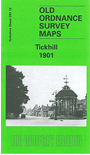
    This detailed map covers the historic village of Tickhill, a few miles south of Doncaster. Our map is double-sided to give maximum coverage. The main map covers the centre and east of the village, including North Gate, Castle Gate and Market Place; from here coverage goes east along Sunderland Street to Spital Hill and part of Sandrock Park. Features include the castle site, Tickhill Mill, Tollbar Bridge, Moor House, Tickhill Low Common, St Leonard's Hospital. On the reverse we include half of adjacent sheet 291.09 extending coverage west, including St Mary's church, Lindrick, West Gate, Lindrick Square, Tickhill Priory, Friary Farm and Limestone Hill.


  • You can order maps direct from our On-line Mapshop. For other information and prices, and other areas, go to The Index Page.
  • Maps in the Godfrey Edition are taken from the 25 inch to the mile map and reduced to about 15 inches to the mile. Follow this link for a complete list of our Doncaster maps; or here for the whole Yorkshire series.
    Alan Godfrey Maps, Prospect Business Park, Leadgate, Consett, Co Durham, DH8 7PW / sales@alangodfreymaps.co.uk / 20 Sept 2016