Old Ordnance Survey Maps of Yorkshire

  • These detailed maps normally cover an area of about one and a half miles by one mile. Each map includes an introduction.
  • They are available through our On-line Mapshop

  • Here are the details of maps for Doncaster (East):

  • Yorkshire Sheet 285.02 Doncaster (East) 1928 - published 2025; intro by Alan Godfrey. ISBN.978-1-78721-930-4

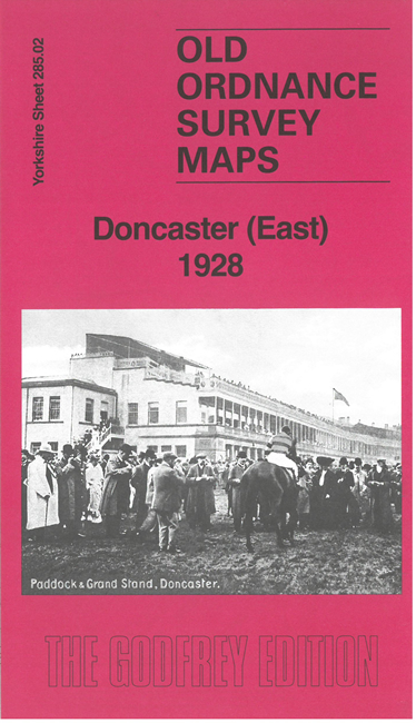
    This map covers the east part of Doncaster around the racecourse, with coverage extending southward to Hawk Hill.

    Features include Doncaster racecourse, Hawk Hill, Rose Hill, South Yorkshire Joint Railway, Belle Vue, football ground, Yorkshire Institution for the deaf.

    On the reverse we include a section of adjacent sheet 277.14 covering the Intake Estate. We also include an introduction to the area's history by Alan Godfrey.

    The map links up with Yorkshire Sheet 285.01 Doncaster (South) to the west.


    For other information and prices, and other areas, go to The Index Page.
  • Maps in the Godfrey Edition are taken from the 25 inch to the mile map and reduced to about 15 inches to the mile. Follow this link for a complete list of our Doncaster maps; or here for the whole Yorkshire series.
    Alan Godfrey Maps, Prospect Business Park, Leadgate, Consett, Co Durham, DH8 7PW / sales@alangodfreymaps.co.uk / 7 November 2025