
 Here are the details of maps for Penistone:

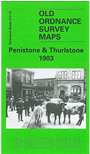
This detailed map covers the area from Thurlstone eastward to Penistone and Spring Vale, and northward to Scout Bridge. Features at Thurlstone (on the west side of the map) include Plumpton Mills, Hornthwaite, Top o' th' Town, Thurlstone Mills, Stanley Mills, Hornthwaite Hill. Near the centre of the map is Bridge End, with Penistone Workhouse, Netherfield Congregational Church, Penistone Bridge. In the SE quarter of the map is the small town of Penistone, with its station and Huddersfield Junction, church, Shrewsbury Road, Market Place, schools etc. Penistone grew in the 2nd half of the 19th century when the Yorkshire Steel & Iron Works (later Cammel Laird's) was opened, the population growing to 3,071 by 1901. On the reverse we therefore include a portion of adjacent sheet 273.16, extending coverage east to include the steel works, the community of Spring Vale that developed around it, Spring Vale Box Works and Kirkwood Mill. Directories of Penistone and Thurlstone are also included.
Maps in the Godfrey Edition are taken from the 25 inch to the mile map and reduced to about 15 inches to the mile.
Alan Godfrey Maps, Prospect Business Park, Leadgate, Consett, Co Durham, DH8 7PW / sales@alangodfreymaps.co.uk / 28 January 2018