We have very good coverage for Kirklees Metropolitan Borough, which was formed in 1974 from the Dewsbury and Huddersfield County Boroughs, Batley and Spenborough Municipal Boroughs, and Colne Valley, Denby Dale, Heckmondwike, Holmfirth, Kirkburton, Meltham and Mirfield Urban Districts.
The following titles are all taken from the OS 25" maps and reduced to a scale of approximately 14 inches to the mile. Each covers an area of a mile and a half by one mile, and includes an introduction. Click on the links below for further details. All maps are available from our On-line Mapshop.
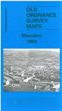 Here are the details of maps for Marsden:

Marsden is fascinating town, spectacularly sited at the head of the Colne Valley, and sometimes used as an alternative setting for the television series Last of the Summer Wine. Our map covers most of the town (or large village) in great detail, with coverage extending southward to Netherley. Features include the LNWR railway with Marsden station and the entrance to Standedge Tunnel; Huddersfield Canal, with several locks and the tunnel entrance and Tunnel End Reservoir; Bank Bottom Mills, Clough Lee, Warehouse Hill, New Mills, Marsden Foundry, Inner Hey, Clough Lee Mills, Gate Head, St Bartholomew's church, Marsden Mills. A tramway is shown running south for construction work on the new Butterley Reservoir, being built at this time. A 1900 directory is also included.