We have very good coverage for Kirklees Metropolitan Borough, which was formed in 1974 from the Dewsbury and Huddersfield County Boroughs, Batley and Spenborough Municipal Boroughs, and Colne Valley, Denby Dale, Heckmondwike, Holmfirth, Kirkburton, Meltham and Mirfield Urban Districts.
The following titles are all taken from the OS 25" maps and reduced to a scale of approximately 14 inches to the mile. Each covers an area of a mile and a half by one mile, and includes an introduction. Click on the links below for further details. All maps are available from our On-line Mapshop.
 Here are the details of maps for Batley (E):

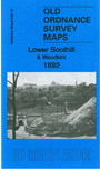
This detailed map covers Lower Soothill, just east of Batley, and extends eastward to Woodkirk church.
Features include Babes in the Wood colliery, St Mary's church Woodkirk, Woodkirk station, Soothill Wood Pleasure Gardens, Lady Ann Mills, ruins of Howley Hall, Soothill Wood Colliery, part of Batley station, Soothill Hall etc. We include directories of Soothill and West Ardsley on the reverse.
The map links up with sheet 232.08 Morley South to the north, 232.11 Batley to the west and 232.16 Hanging Heaton to the south.