We have very good coverage for Kirklees Metropolitan Borough, which was formed in 1974 from the Dewsbury and Huddersfield County Boroughs, Batley and Spenborough Municipal Boroughs, and Colne Valley, Denby Dale, Heckmondwike, Holmfirth, Kirkburton, Meltham and Mirfield Urban Districts.
The following titles are all taken from the OS 25" maps and reduced to a scale of approximately 14 inches to the mile. Each covers an area of a mile and a half by one mile, and includes an introduction. Click on the links below for further details. All maps are available from our On-line Mapshop.
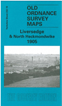 Here are the details of maps for Liversedge:

This detailed map covers parts of Liversedge and Heckmondwike, while the hamlet of White Lee is in the top right corner. Liversedge LYR station is in the bottom left corner. Features include Station Lane, Christ Church, Healds Hall, tramway depot, LNWR station, Victoria Mills, Well Fold, Thornbush Farm, Lower Popeley, Westfield; the portion of Heckmondwike includes Victoria Colliery, disused Ings Mill, Nunroyd, cemetery, Longfield Mills, Heckmondwike Chemical Works. To the east are The Crofts, White Lee Common, Dale Lane Top, New Brighton Mills, Ridings Mills, White Lee Colliery. At the top of the map is a portion of Gomersal, incl Castle House, California Foundry, Union Mills. Despite the awkward sheetlines, there is much of interest on this map. On the reverse we include an 1889 directory of Liversedge.
The map links up with sheet 232.09 Hightown to the west, 232.06 Gomersal to the north, 232.11 Batley to the east, 232.14Heckmondwike to the south.