Old Ordnance Survey Maps of Yorkshire

  • These detailed maps normally cover an area of about one and a half miles by one mile. Each map includes an introduction.
  • They are available through our On-line Mapshop

  • Here are the details of maps for Barnoldswick:

  • Yorkshire Sheet 183.04 Barnoldswick 1907 - published 2005; intro by Alan Crosby. ISBN.978-1-84151-792-6

    This is a detailed map of Barnoldswick, a small Yorkshire mill town which since council reorganisation is now in Lancashire. The Barnoldswick Branch of the Midland Railway travels from the south-east of the map into the town, with its Station being close to Foresters Buildings. Butts Mill and Calf Hall Shed are in the centre of the map, east of Higher Calf Hall. Other points of interest include Clough Mills, Moss & Long Ing Shed and Well House Mill. The reverse side of the map features extracts from a contemporary directory, including the Midland Railway Timetable 1916.

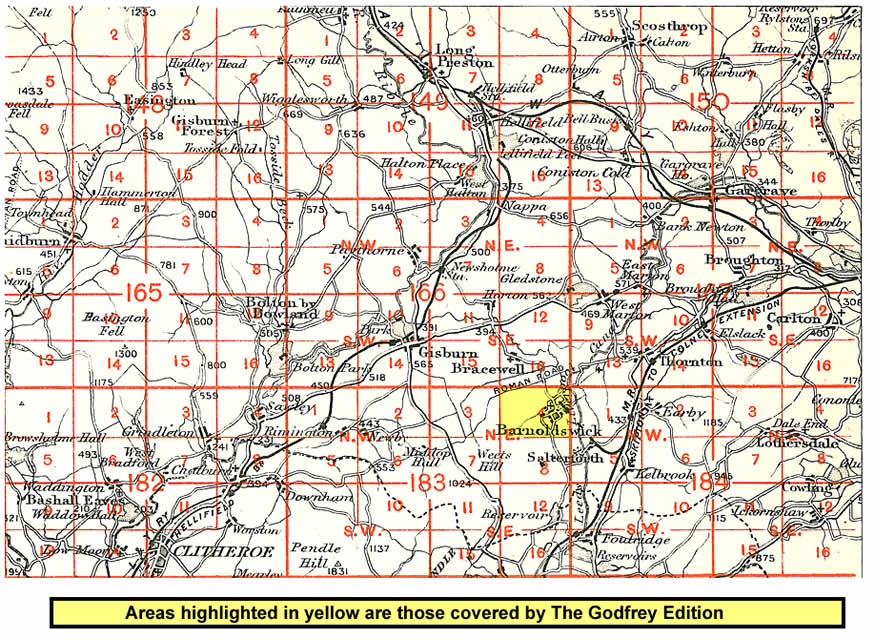
    And here is an index map showing the area covered.


  • You can order maps direct from our On-line Mapshop. For other information and prices, and other areas, go to The Index Page.
  • Maps in the Godfrey Edition are taken from the 25 inch to the mile map and reduced to about 15 inches to the mile. Follow this link for a complete list of our North Yorkshire maps; or here for the whole Yorkshire series.
    Alan Godfrey Maps, Prospect Business Park, Leadgate, Consett, Co Durham, DH8 7PW / sales@alangodfreymaps.co.uk / 25 January 2018