 Here are the details of maps for Coombeswood:

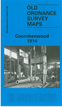
This detailed map covers part of the Halesowen hamlets of Hill, Cakemore and Coombeswood. Coverage stretches from Lewis Lane eastward to Ridgacre Road, and from Maltmill Lane southward to Furnace Lane.
Features include a short stretch of the GWR Netherton & Halesowen line, The Furnace, Heywood Forge with mineral railway, Mucklow Hill, Greenhill Farm, Long Lane area, Coombeswood Tube Works, Gorsty Hill, Cockshot, Olivehill Farm, Haggs Farm, Coombes Wood Colliery, Dudley Canal etc. On the reverse we include a section of the 1st Edition 1883 map for the Mucklow Hill area westward to The Furnace.
The map links up with Worcestershire sheets 4.12 Cradley South to the west, 5.10 Quinton to the east and 5.13 Halesowen East to the south; and Staffordshire sheet 72.05 Rowley Regis to the north.