Old Ordnance Survey Maps of Westmorland

  • These detailed maps normally cover an area of about one and a half miles by one mile. Each map includes an introduction.
  • They are available through our On-line Mapshop

  • Here are the details of maps for Kendal:

  • Westmorland Sheet 38.08 Kendal 1911 - published 1991, 2nd edition 2014; intro by Alan Godfrey. ISBN.978-1-84784-813-0

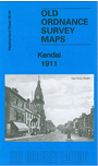
    This detailed map covers the centre of Kendal, with coverage stretching from Sandes Avenue southward to Romney Road, and from Ghyll Brow eastward to Castle Street.

    Features include town centre with individual buildings neatly shown, Kendal Castle, Boot Factory, Stricklandgate and High Street area in detail, County Hospital, River Kent, Castle Mills, Abbot Hall, Sanatorium, Cemetery, Holy Trinity church, Serpentine Walks, Dalton House, Goose Holme, Maude's Meadow, mills, Nether Bridge, Mill Bridge, Stramongate Bridge, Grammar School, The Lound, Gillingrove Brewery etc. We include a list of Private Residents from a 1914 directory on the reverse.

    The map links up with sheet 38.04 Kendal (North) to the north.


  • Follow this link for a complete list of our Westmorland Series maps or for all our Cumbria maps.
  • You can order maps direct from our On-line Mapshop. For other information and prices, and other areas, go to The Index Page.
  • Maps in the Godfrey Edition are taken from the 25 inch to the mile map and reduced to about 15 inches to the mile. For a full list of maps for England, return to the England page.
    The Godfrey Edition / sales@alangodfreymaps.co.uk / 9 January 2018