 Here are the details of maps for Windsor:

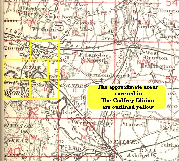
We have published two maps of Windsor. These link up with each other to provide good coverage of the town. They also link up with maps for Eton and Slough to provide an interesting block of 4 maps. This index map shows how they link up.
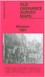
The map simply called Windsor covers the west of the town, an area stretching from the GWR station and Peascod Street eastward to Dedworth Manor. Features include much of the town centre, Victoria Street, Windsor Bridge, the southern part of Eton High Street, Clarence Road, Alma Road, New Road, Holy Trinity church, St Mark's School, Victoria Barracks, All Saints church, Clewer New Town, St Andrew's Hospital, Clewer Hall, Clewer, Clewer Mill. A commercial directory A-P is on the reverse.
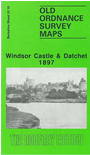
The Windsor Castle & Datchet map covers the east of the town, and an area eastward to Datchet. Features include Windsor Castle, LSWR station, Royal Mews, The Long Walk, High Street, Castle Hill, Frogmore Cottage, Frogmore House, Adelaide Lodge, Victoria Bridge. On the east side of the Thames are Datchet station, St Mary's church, Southlea, Churchmead House, Datchet village. On the reverse we include a section of sheet 32.06 extending coverage north to Mirk, Riding Court, Upton Court, St Lawrence's church, and the fringe of Slough.