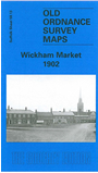
Suffolk Sheet 59.13 Wickham Market 1902 - published 2006; introduction by Robert Malster. ISBN 978-1-84151-864-0 
This detailed map provides good coverage of the small town of Wickham Market, with coverage continuing north of the River Deben to Glevering Hall
Farm and part of Glevering Park. Features in the town include All Saints church, The Hill, Snowdon Hill, Upper Street, Middle Street, Lower Street,
Wickham Bridge, Wickham Mill, Gelham Hall. On the reverse we include directories of both Wickham Market and Hacheston in 1896.
Follow this link for a complete list of our Suffolk Series maps.
You can order maps direct from our On-line Mapshop.
For other information and prices, and other areas, go to The Index Page.
Maps in the Godfrey Edition are taken from the 25 inch to the mile map and reduced to about 15 inches to the mile.
For a full list of maps for East Anglia, return to the East Anglia page.
The Godfrey Edition / sales@alangodfreymaps.co.uk / 24 November 2017

 Here are the details of maps for Wickham Market