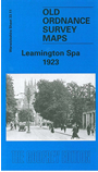
 Here are the details of maps for Leamington Spa:

This detailed map covers most of the town centre of Leamington, here fully named as Royal Leamington Spa, with coverage stretching from Russell Terrace and Spencer Street northward to Lillington Avenue, and from Oswald Road and Warwick New Road eastward to Campion Hills and Newbold Farm. The many features include Pump Room Gardens, Manor House Hotel, All Saints church, Jephson Gardens, River Leam, Regent Hotel, Newbold Comyn, Newbold Beeches, Royal Pump Room, Municipal Building, tramway, Avenue station (most of railway is on South map), Adelaide Bridge, Milverton, Christ Church, Holy Trinity church, Leamington College, Leamington Brewery, Beech Lawn Prep School, Leamington & Lillington Brick Works, and many well laid out streets, with individual houses neatly shown. On the reverse we include entries A-Gr from a list of private residents from a 1921 directory.
The map links up with sheets 33.15 Leamington South to the south and 33.10 Warwick North to the west.