 Here are the details of maps for Longbenton:

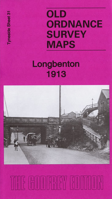
This detailed map covers most of Longbenton, with coverage stretching from Gosforth Row eastward to Benton station.
Features include Billy Pit, Little Benton, Benton station and NER line, Benton House, Manor House, Benton Frm, Benton Lodge, Benton Place, Benton Quarry Junction. On the reverse we include a section of the adjacent sheet, extending coverage eastwrad to include the NER main line, East Benton and the disused Bigges Main Colliery.
Lonbgbenton was an independent urban district until 1974, when it was absorbed into the new North Tyneside Metropolitan Borough.
The map links up with Tyneside Sheets 32 Forest Hall to the north, 30 Gosforth to the west and 5 High Heaton to the south.
Maps in the Godfrey Edition are taken from the 25 inch to the mile map and reduced to about 15 inches to the mile. For a full list of maps for the North East, return to the North East page.
The Godfrey Edition / sales@alangodfreymaps.co.uk / 23 July 2020