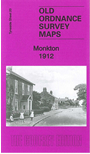
 Here are the details of maps for Monkton:

This detailed map covers the village together with small portions of Hebburn and Jarrow.
Features include Monkton village, Primrose Hill Hospital, Springwell Paper Mills, Pontop & Jarrow Railway, Burn Heads, Hebburn cemetery, St John's church, Hebburn Infirmary. We include a 1906 directory of Monkton and Hebburn New Town on the reverse.
This map links up with Tyneside Sheet 14 Jarrow to the north, Sheet 19a St Anthony's to the west and Durham Sheet 3.16 Brockley Whins to the east.
Maps in the Godfrey Edition are taken from the 25 inch to the mile map and reduced to about 15 inches to the mile. For a full list of maps for the North East, return to the North East page.
The Godfrey Edition / sales@alangodfreymaps.co.uk / 10 January 2023