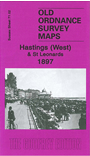
 Here are the details of the map for west Hastings:

This detailed map covers the western part of Hastings, incl most of the 'new town', together with part of St Leonards. Coverage stretches form St Leonards Pier eastward to Hastings castle remains.
Features include St Leonards and Hastings Piers, Warrior Square station, Hastings station, St Michael's RC church, St Andrew's church, St Mary's church, Holy Trinity church, Queen's Hotel, Wellington Square, Town Hall, Bohemia House, Warrior Square, St John's church, Gensing Gardens, St Leonards Gardens, St Paul's church, Royal Victoria Hotel, etc. On the reverse we include entries A-F from a list of private residents from a 1905 directory.
The map links up with sheet 71.03 Hastings Old Town to the east.