Old Ordnance Survey Maps of Brighton & Hove

  • These detailed maps normally cover an area of about one and a half miles by one mile. Each map includes an introduction.
  • They are available through our On-line Mapshop

  • Here are the details of maps for Brighton Kemp Town:

  • Sussex Sheet 66.14 Brighton (Kemp Town & Palace Pier) 1930 - published 2024; intro by Alan Godfrey. ISBN.978-1-78721-763-8

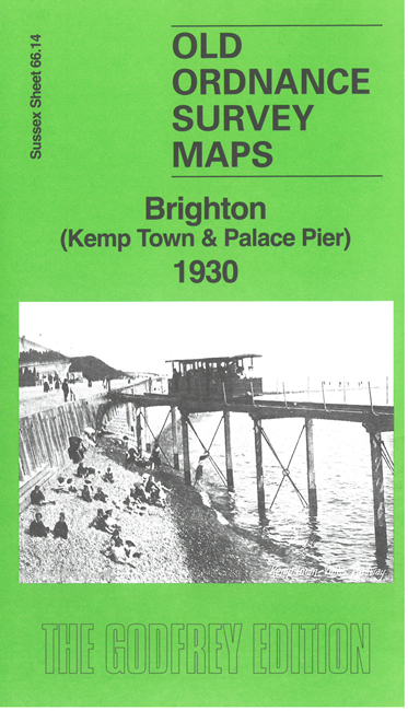
    This detailed map covers the Kemp Town area of Brighton and we also include, as an inset, sheet 66.13 which shows the Palace Pier, Aquarium and part of Brighton Esplanade.

    Features include Black Rock, Volks Railway, St George's Church, Sussex Square and the other major buildings of Kemp Town, Royal Sussex County Hospital, Royal Crescent, Marine Parade, etc.


  • Follow these links for complete lists of our West Sussex and East Sussex maps. For other information and prices, and other areas, go to The Index Page.
  • Most maps in the Godfrey Edition are taken from the 25 inch to the mile map and reduced to about 15 inches to the mile. For a full list of maps for England, return to the England page.
    The Godfrey Edition / sales@alangodfreymaps.co.uk / 27 May 2024