Old Ordnance Survey Maps of East Sussex

  • These detailed maps normally cover an area of about one and a half miles by one mile. Each map includes an introduction.
  • They are available through our On-line Mapshop

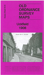
  • Here are the details of the map for Uckfield:

  • Sussex Sheet 40.04 Uckfield 1908 - published 2013; intro by Richard Oliver. ISBN.978-1-84784-681-5

    This detailed map covers gives good coverage of the small town of Uckfield, with coverage stretching from the Agricultural College and Harcourt Road northward to Downland Farm, and from Butcher's Wood eastward to St Saviour's church.

    Features include railway with station, St Saviour's church, Uckfield House, Old Workhouse, The Rocks, Downland Farm, Holy Cross church, Public Hall, cottage hospital, The Grange, Copwood, abandoned railway, etc. On the reverse we include a 1905 commercial directory of Uckfield.


  • Follow these links for complete lists of our West Sussex and East Sussex maps.
  • You can order maps direct from our On-line Mapshop. For other information and prices, and other areas, go to The Index Page.
  • Most maps in the Godfrey Edition are taken from the 25 inch to the mile map and reduced to about 15 inches to the mile. For a full list of maps for England, return to the England page.
    The Godfrey Edition / sales@alangodfreymaps.co.uk / 1 December 2016