Old Ordnance Survey Maps of Staffordshire

  • These detailed maps normally cover an area of about one and a half miles by one mile. Each map includes an introduction.
  • They are available through our On-line Mapshop

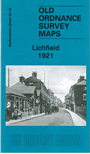
  • Here are the details of maps for Lichfield:

  • Staffordshire Sheet 52.15 Lichfield 1921 - published 2010; intro by Malcolm Nixon. ISBN.978-1-84784-368-5

    This detailed map covers most of Lichfield, with coverage stretching from Christ Church eastward to Trent Valley Road and from Curborough Road southward to Borrowcop House.

    Features include city centre with individual buildings neatly delineated; Cathedral, St Michael's church, railway with station, malthouses, King Edward's School, Lichfield Workhouse, Smithfield Cattle Market, City Brewery, Chritschurch Gardens, Palace, Theological College, St Mary's church, Market Place, Holy Cross RC church, The Friary, Lichfield Brewery, Beacon Place, picture theatre, etc. On the reverse we include a list of private residents from a 1912 directory.


  • For a full list of maps of Staffordshire county, please go to the Staffordshire page or the Potteries page.
  • You can order maps direct from our On-line Mapshop. For other information and prices, and other areas, go to The Index Page.
  • Maps in the Godfrey Edition are taken from the 25 inch to the mile map and reduced to about 15 inches to the mile. For a full list of maps for England, return to the England page.
    Alan Godfrey Maps, Prospect Business Park, Leadgate, Consett, Co Durham, DH8 7PW / sales@alangodfreymaps.co.uk / 28 January 2018