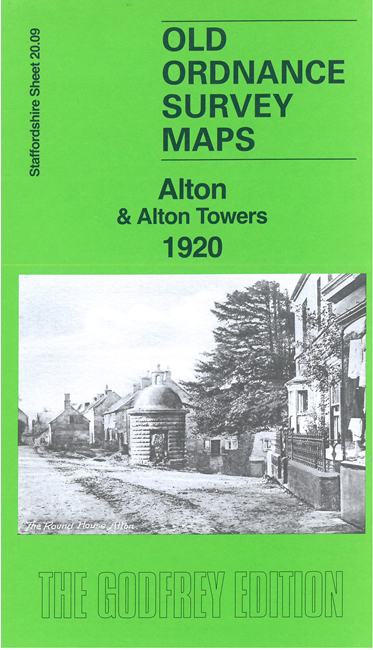
Staffs 20.09 Alton & Alton Towers 1920 - published 2024; intro by Barrie Trinder. ISBN.978-1-78721-746-1 
This detailed map is double-sided for maximum coverage and gives very good coverage of Alton.
Features include town centre with individual buildings neatly shown, railway with station, St Peter's church, The Castle, Convent School, River Churnet,
Alton Towers, St Peter's Chapel, Flag Tower, fountains and grounds, Farley Park, Lord's Bridge, Threap Wood, Tithebarn, Round House, Gallows Green, etc
For a full list of maps of Staffordshire, please go to the Staffordshire page or the
Potteries page.
You can order maps direct from our On-line Mapshop.
For other information and prices, and other areas, go to The Index Page.
Maps in the Godfrey Edition are taken from the 25 inch to the mile map and reduced to about 15 inches to the mile.
For a full list of maps for England, return to the England page.
Alan Godfrey Maps, Prospect Business Park, Leadgate, Consett, Co Durham, DH8 7PW /
sales@alangodfreymaps.co.uk / 27 May 2024
 Here are the details of maps for Alton: