 Here are the details of maps for Longton (West):

Part of our extensive coverage of The Potteries, this detailed map covers the western part of Longton, including the Dresden area. Coverage stretches from Vauxhall Street and Rosslyn Road westward to Longton Mill, and from Longton station southward to Queens Park.
Features include Cemetery, Dresden area with streets of small terraces, Blurton Green Farm, St Paul's church, Town Hall, tramways, potteries and earthenware manufactories, Longton Hall Colliery, Longton Hall, Swingle Hill, disused iron works, mineral lines, Blurton Tileries, Hollybush Farm etc. On the reverse we include directory extracts including a Dresden & Florence Alphabetical List for 1892-3.
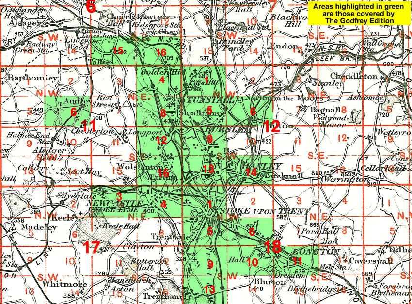
The map links up with sheets 18.06 A HREF="staffs1806.htm">Fenton to the north, 18.09 Trent Vale to the west and 18.11 Longton East to the east.
You might find this Index Map useful.