Old Ordnance Survey Maps of Staffordshire

  • These detailed maps normally cover an area of about one and a half miles by one mile. Each map includes an introduction.
  • They are available through our On-line Mapshop

  • Here are the details of maps for Knutton:

  • Staffordshire Sheet 11.15 Knutton & Apedale Iron Works 1922 - published 2023; intro by Barrie Trinder. ISBN.978-1-78721-681-5

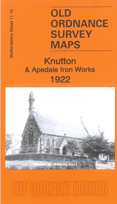
    This detailed map covers a post-industrial area NW of Newcastle with a landscape marked by old coal and industrial workings. The one village is Knutton and the map covers the S part of Apedale Iron Works with the Footrails Colliery. Also shown are Holditch Colliery, mineral and railway lines, Black Bank and Gorsty Bank.

    The map links up with Staffordshire Sheets 11.11 Chesterton to the north, 11.14 Scot Hay to the north, 11.16 Wolstanton to the east and 17.03 Silverdale to the south.

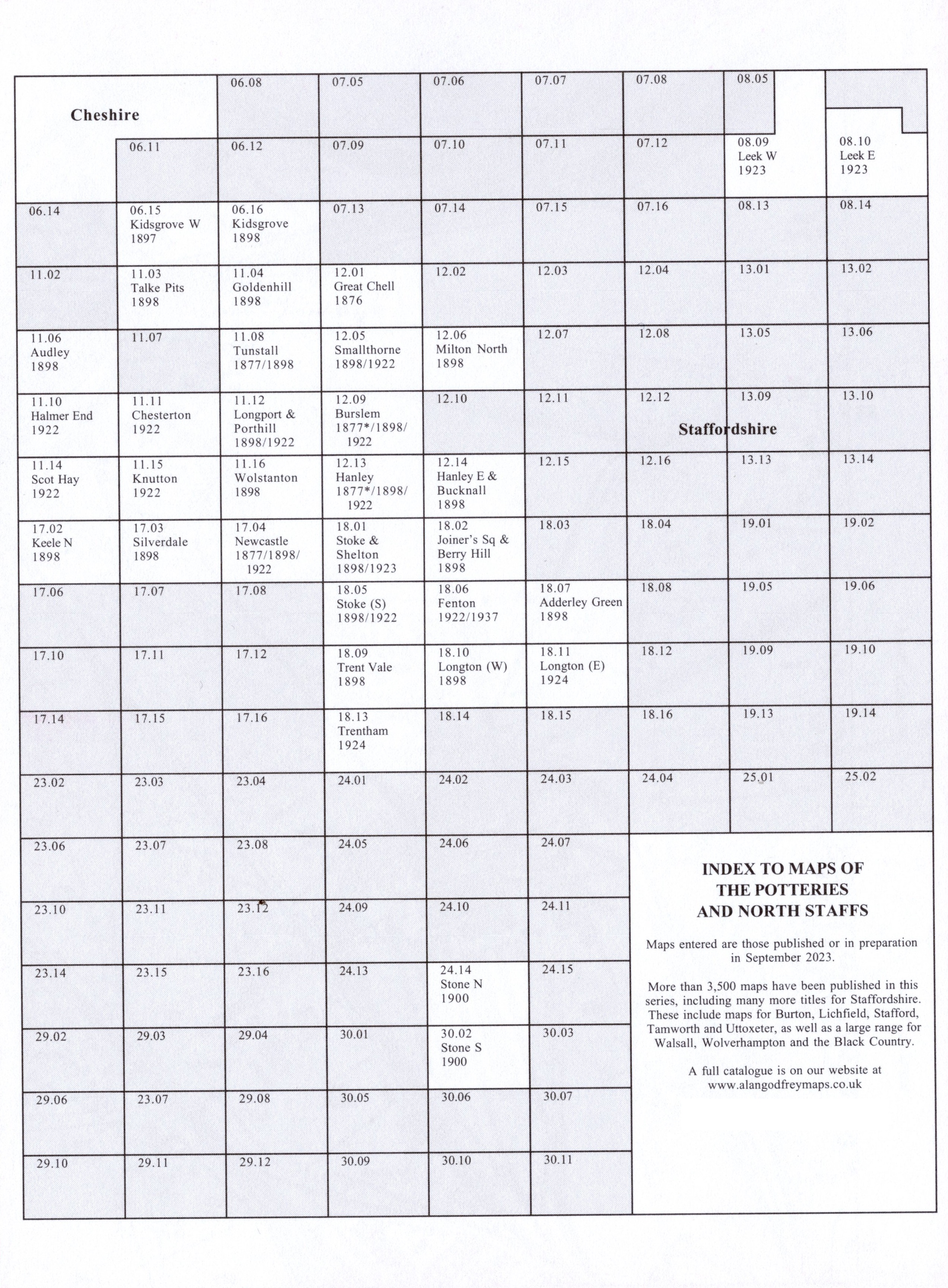
    You might find this Index Map useful.


  • For a full list of maps of Staffordshire, please go to the Staffordshire page or the Potteries page. For other information and prices, and other areas, go to The Index Page.
  • Maps in the Godfrey Edition are taken from the 25 inch to the mile map and reduced to about 15 inches to the mile. For a full list of maps for England, return to the England page.
    Alan Godfrey Maps, Prospect Business Park, Leadgate, Consett, Co Durham, DH8 7PW / sales@alangodfreymaps.co.uk /27 November 2023