
Old Ordnance Survey Maps of Shropshire
These detailed maps normally cover an area of about one and a half miles by one mile. Each map includes an introduction.
They are available through our On-line Mapshop
 Here are the details of maps for Shifnal:
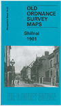
Shropshire Sheet 44.01 Shifnal 1901 - published 2004; intro by Barrie Trinder. ISBN.978-0-84151-611-0 
This detailed map of Shifnal is double-sided for maximum coverage. The main maps coverage stretches as far north as Haughton and as far south as the Star Hotel. Features include Aston Hall, Haughton Hall, Gas Works, Smithfield Cattle Market, Railway Line & Station and St Mary's RC Chapel. The second map on the reverse includes the area to the south showing St Andrew's Church, Shifnal Union Workhouse and Beech House. We also include a list of private residents for the area.
Follow this link for a complete list of our Shropshire or Telford maps.
You can order maps direct from our On-line Mapshop.
For other information and prices, and other areas, go to The Index Page.
Maps in the Godfrey Edition are taken from the 25 inch to the mile map and reduced to about 15 inches to the mile.
For a full list of maps for England, return to the England page.
The Godfrey Edition / sales@alangodfreymaps.co.uk / 30 January 2018