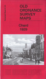
Somerset Sheet 91.04 Chard 1929 - published 2017; introduction by Tony Painter. ISBN.978-1-78721-087-5 
This detailed map gives good coverage of Chard, with coverage stretching from High Street and Crimchard Works eastward to Venns Farm.
Features include town centre with individual buildings neatly shown, Crimchard Works, Holyrood Mill, Old Lace Mills, Church of the Good Shepherd,
Phoenix Iron Works, St Mary's church, Chard Farm, Chard Joint station and railway, Station Road Iron Works, Goods Station, Poor Law Institution,
Fordham Grange, Lordsleaze Farm, Oaklands etc. Extracts from a 1902 directory are included on the reverse.
Follow this link for a list of our maps for Somerset or here for a general list for the South West.
You can order maps direct from our On-line Mapshop.
For other information and prices, and other areas, go to The Index Page.
Maps in the Godfrey Edition are taken from the 25 inch to the mile map and reduced to about 15 inches to the mile.
For a full list of maps for England, return to the England page.
Alan Godfrey Maps, Prospect Business Park, Leadgate, Consett, Co Durham, DH8 7PW / sales@alangodfreymaps.co.uk / 13 January 2018

 Here are the details of maps for Chard: